The US alone had 24.7 million downloads of Google Maps in 2022. The data clearly shows the popularity and inclination of users toward Google Maps. And its popularity can be seen in the corporate world as well. Professionals use Google Maps as a CRM mapping solution to locate leads, contacts, accounts, or opportunities and visualize them like never before.
Google Maps in Dynamics 365 can be seen on Dashboards, record forms, while filtering records, to create an optimized route, and more.
Dynamics 365 CRM users find it difficult to find a tool that offers Google Maps integration because most mapping tools use Bing Maps as their default mapping solution.
However, Dynamics 365 map offers both Google Maps and Bing Maps integration for its users to plot locations on maps.
There are three significant ways to use Google Maps as your CRM mapping solution:
1. Geocode CRM records on Google Maps
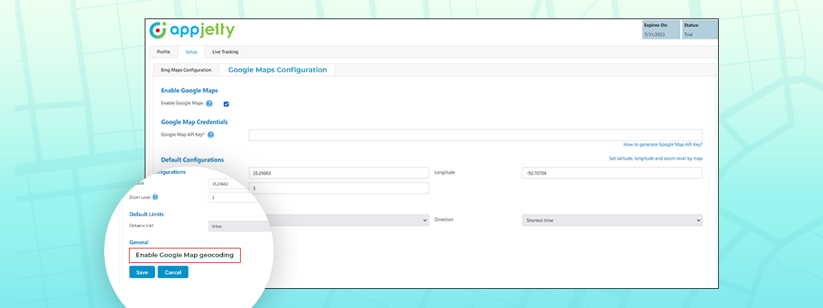
Google Maps gives the most accurate latitude and longitude. Thus, while plotting the data on map, you will have the most accurate results.
We also have a detailed blog on how to configure Google Maps in MappyField 365 and how you can geocode locations.
2. View CRM records on Google Maps
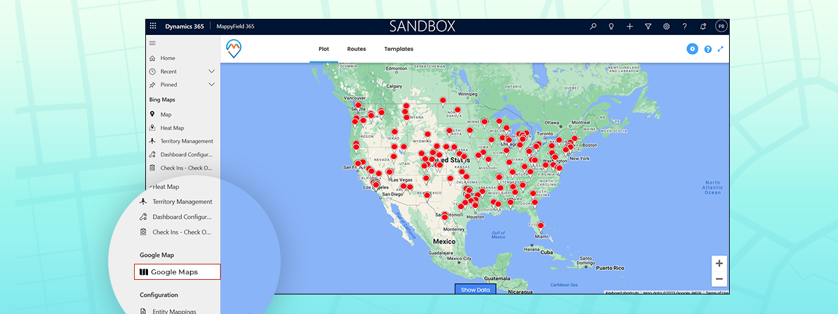
MappyField 365 lets Dynamics CRM users visualize their data by placing entity records on a map. It provides a series of actions that can be performed on plotted records. The actions usually performed on a Dynamics CRM entity record are available from within the map, like add to marketing list, send email, etc.
3. Route Optimization using Google Maps
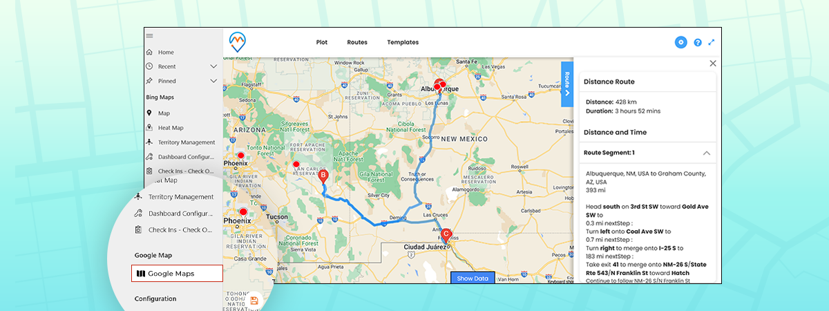
The purpose of optimizing routes is to reduce traveling time and distance. What could be a better option than Google Maps? None!
MappyField 365 lets you add routes and navigate directly to Google Maps. If you want to learn how you can do it, we have a detailed blog explaining how to configure it.
If you wish to use Google Maps for geocoding locations, data plotting, or while optimizing routes, MappyField 365 got you covered. Use Google Maps for Dynamics 365 CRM using MappyField. Contact our sales team for more information about MappyField and how it uses Google Maps to ease your sales team’s life at [email protected]. If you want to have a real time experience of this, book a demo with us.
All product and company names are trademarks™, registered® or copyright© trademarks of their respective holders. Use of them does not imply any affiliation with or endorsement by them.


